Monday, April 22, 2013

Nowhere to go but up

Today, Earth Day, is an appropriate conclusion to this chapter of the Fraser River expedition.  As I unpack the information held in these samples over the coming months, I hope to learn about how this river transmits the products of photosynthesis and respiration on land to the coastal ocean.  What sort of role does the Fraser play in global exchanges of carbon between the air, rocks, plants, soil, and water?  How will these processes change in the future as the Earth warms?  For rivers, which cross the boundaries between land, ocean, and atmosphere, answering these questions has never been more important.  Luckily, working on these problems also happens to be a lot of fun.
 
After two weeks of almost uninterrupted grey weather, even the stubborn locals here started to stay indoors.  Thursday and Friday introduced me to a new experience: I finished sampling without a visit from a single rower, canoe team, or wandering dog-walker.  Fort Langley felt deserted, save for the occasional passing freight train.  Then suddenly, the sun returned and this afternoon the town was abuzz with shoppers, gelato-fueled children, and everyone else with an acute vitamin D deficiency within a 5-mile 
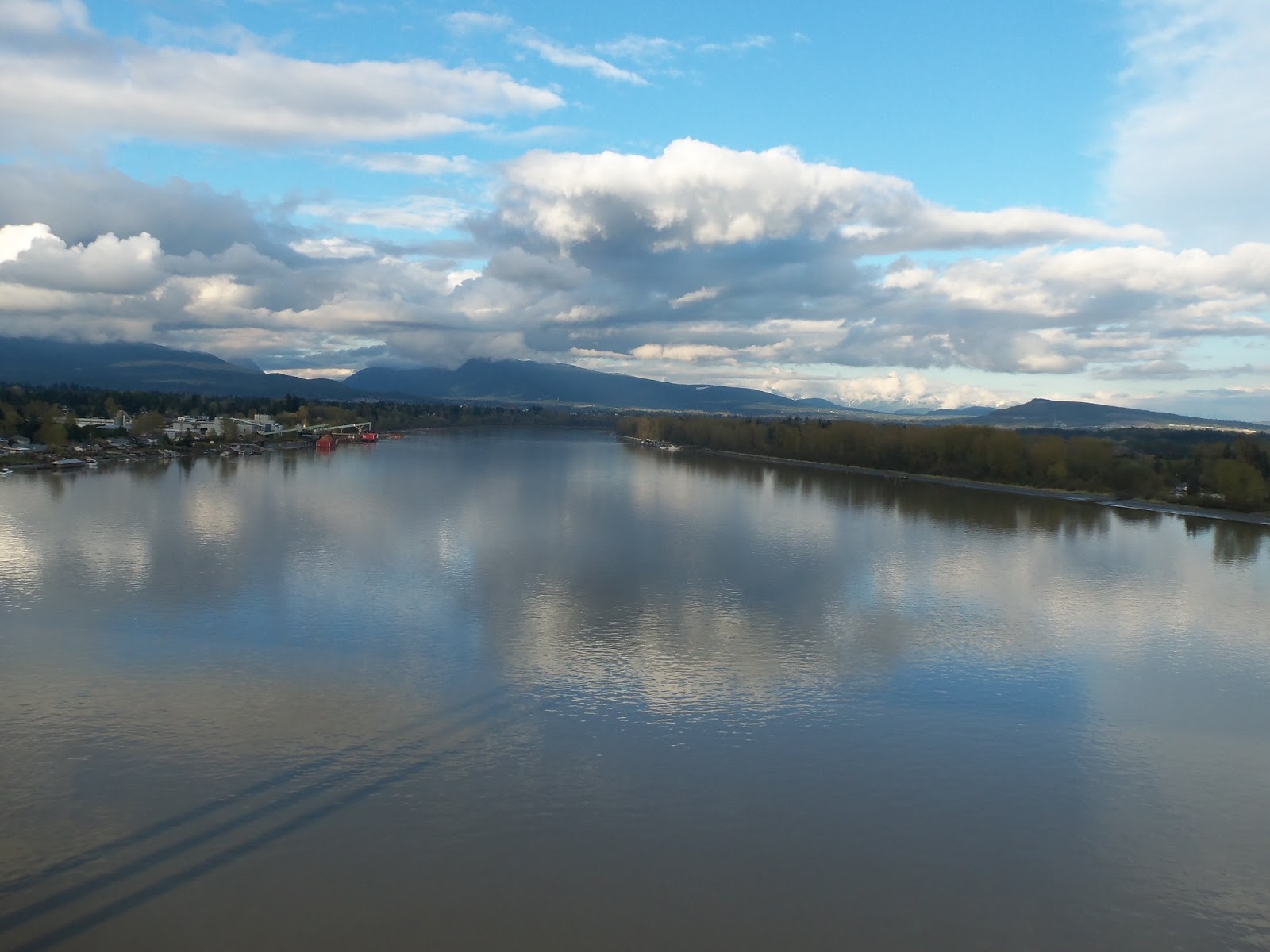
radius.  But the sampling dock was still a peaceful haven with the quiet hum of the river and phenomenal views of the nearby mountains.

On Saturday, the whole UFV team came out for one last group sampling session.  The skies defied the forecast and spared us from getting drenched.  We celebrated our luck by posing for a few group photos.  My ultra-high-frequency sampling is drawing to a close, but the students will keep coming out every week or two.  My early-freshet samples have hopefully captured the rapid pulse of DOC in exciting detail, and the sampling throughout the summer will characterize the bulk of the year’s other chemical fluxes.

In the span of only a few short weeks, I’ve watched the water flow of the Fraser increase to about 3x its winter baseline level. Turbidity (or muddiness) has spiked twice, maxing out at over 20 times its initial value. Dissolved organic carbon concentration, according to the fluorescent probe, has approximately tripled. The other more nuanced changes will have to wait for sample analysis to be revealed. I can’t wait to see what these samples have to tell us about how the chemistry of the Fraser River responds to the transition into summer!

Wednesday, April 10, 2013

On the pulse


If spring is supposed to come in like a lion and go out like a lamb, the Northwest is doing it wrong.  The summer-like weather of two weeks ago shifted abruptly back to winter phase, punctuated this morning by incessant heavy rain and wind that reminded me of Cape Cod.  Through it all, the Fraser is doing its best to transition to freshet mode.  The cooler weather has slowed its initial surge, but the water level, along with turbidity and dissolved organic matter, are still on the rise.

I want to focus today on the water samples I’m collecting and why I came here in the first place.  As alluded to in a previous post, our fantastic time series record, made possible through the hard work of numerous students and their faculty advisors at UFV, has shown some intriguing trends.  In particular, we saw a spike in the concentration of dissolved organic carbon (DOC) at the very beginning of the 2011 spring freshet.  By spike, I mean in a matter of a few weeks, the concentration increased by about 4x.  For comparison, concentrations of inorganic species, like calcium and chloride, decreased during this period.  Since this pulse is so rapid, even our time series samples (at about every other week) couldn't fully capture it.  So I came back with the goal of tracking this event at extra-high frequency to see how this DOC lines up with other changes in the river, and possibly changes in the composition of the DOC itself.

So in addition to DOC concentration, I’m also collecting samples for dissolved inorganic carbon, carbon isotopes, DOC incubations, nutrients, major and trace elements, water isotopes, and suspended sediments.  Comparing the behavior of all these components will shed light on how this DOC pulse plays out and what drives it.  The optical probe (see last post) is critical for evaluating how DOC concentrations are changing, and for making the anticipation of waiting to analyze all the samples tolerable.

In the interest of ensuring that I don’t miss the peak, I've decided to extend my time here.  Even if it means sleeping in my car—don’t worry, the sampling site has electricity, so I can charge the pump battery!—and hitchhiking back to WHOI, I’m here to see this through!

Saturday, April 6, 2013

The molecules floating in darkness have seen a great light


As I struggled to fill the first of five small bottles with filtered water this afternoon, I decided I was finally ready to accept that the freshet has started.  It’s a miracle I can type at all right now, given the strain my hands have endured today.  Don’t believe me?  I invite you to come over and give it a try.  I’ve already had another visit from helping hands, this time UFV students Audrey and Rosalie (photos).  Even though the fact that I’m here sampling means they don’t have to go out like they usually do, they’ve offered to come and help me!  Little do they know what the river has in store for us…

Aside from the filtration challenge, this change in the river’s composition also has a chemical side.  The main inspiration for this sampling campaign is to characterize the sudden shift in flux and (most likely) composition of dissolved organic carbon (DOC) that occurs during the freshet.  Unfortunately, DOC doesn’t make itself known quite as obviously as sediment.  To see DOC, I need eyes with a slightly different light spectrum from my own.

That’s where my friend the submersible fluorometer comes in.  This device shines ultraviolet light at the water, which excites electrons in organic molecules (sadly, my eyes can’t do that either).  These molecules then emit energy as visible light, which the sensor detects.  The amount of fluorescence depends on the amount of organic compounds in the water, so fluorescence values should be correlated to DOC concentrations.  My fluorometer is submersible, which means I can drop it straight into the river and record fluorescence in the field.

So I was very excited today to see that the fluorescence readings are finally rising above the noise – I’m willing to go on record now and say that the DOC pulse has begun!  Hopefully I will watch it continue to rise and peak in the coming days, meanwhile collecting lots of water samples to make comprehensive chemical measurements back in the lab.  But this probe, along with basic field measurements like temperature and pH, are telling me a lot already.

Thursday, April 4, 2013

It's always sunny in Cascadia


Last week saw just about the nicest weather you could hope for in the Fraser Valley.  In addition to making the water sampling ridiculously pleasant, the solid week of warm sunshine jump-started the snowmelt and the river level is on the rise!  It’s a good thing I got to B.C. when I did, because if this is really the freshet, it’s an unusually early start.

I had a visit over the weekend from some field assistants my parents, who graciously spent their holiday helping me schlep equipment back and forth between the dock, my car, and the “lab.”  We also took advantage of the weather to make some riverside picnics, including a visit to Matsqui Park under the Mission Bridge.  This is the site of the official Fraser River flood height marker (second photo).  The flood crests from 1948 are immortalized in many places around the basin, but as you can see, the flood of 1894 was even greater.  The estimated maximum flow rate at the peak of the 1894 flood was more than twice the average peak flow of the Fraser!  Imagine trying to fit twice as much water in a river channel as it flows across a wide, flat floodplain.  Obviously, you can’t – that’s why they’re called floodplains.  The Fraser Valley today is protected by dikes in most areas, but a large flood would certainly be a damaging event.

The spring freshet is mainly the product of snowmelt.  In 2011 and 2012, above-average snowpack across the basin resulted in much larger freshets than normal, and the reverse was true in 2010.  Peak flow in 2012 was the 4th highest on record (since 1912), while 2010 was the 3rd lowest.  This year, snow depths are more or less average, so I expect this to be an average water year.  Of course, winter isn’t necessarily through in the mountains, but the recent warmth suggests there won’t be any more snow build-up.  Major Fraser River floods are characterized by two factors: sudden melting of large snowpacks and heavy rains.  As I psych myself up to go sampling for the first time in the rain, let’s hope 2013 only meets one of those criteria.

Friday, March 29, 2013

Don't blink!

If you squint really hard, you can just barely make out the first tiny trickle of water melting off the snow on the mountains towering over the Fraser Valley. Okay, maybe not. But if the last few days of balmy weather are to be trusted, the spring freshet can’t be far off.

I’m back in British Columbia to sample the Fraser River during the most dynamic time of year: the spring freshet. This is the most exciting period when the river shifts from its quiet, winter-time state to a rushing torrent of water and mud. As the ground warms and the water level rises, vast stores of sediment, nutrients, and organic matter are flushed off the land and into streams across the basin, drastically changing the chemistry of the water. This is the most important time to sample a river, because the composition of many chemical properties is so different from the rest of the year, and the amount of material exported dwarfs that of the summer, fall, and winter.

Our sampling campaign during the 2011 freshet captured a snapshot of this period all over the basin, in tributaries from the Rocky Mountains to the floodplain. This year, I’m sitting in one spot – our time series location in Fort Langley, near the river mouth – and collecting samples every day to make sure I don’t miss the chemical pulse I expect to see right as the water level begins to rise.

So for now, I’m just settling into my sampling routine and getting to know my new instrumentation. Will this year’s freshet be as big as last year’s – the biggest in 40 years?  Only time will tell…

Wednesday, August 3, 2011

Pass the salt

En route between the Nahatlatch River and the mouth of the Fraser, we made a brief stop at Lytton to observe the mixing of the blue Thompson, the largest tributary of the Fraser River, with the muddy Fraser. The swirling eddies clearly visible at this point provided a natural platform for our resident physical oceanographer, Rocky Geyer, to pontificate on the dynamics of mixing. The two streams remain separate for a considerable distance downstream despite the turbulent flow of the river.

After following the mighty Fraser from its icy beginnings at the base of Rocky Mountain glaciers through raging tributaries of the Cariboo and Coast Mountains, we finally concluded our journey at the estuary near Vancouver, where muddy river water first meets the ocean in the Strait of Georgia. We chartered a whale watching boat to take us across the freshwater-saltwater transition at different tidal stages. Using CTD casts, we watched a wedge of saltwater at depth creep upstream with the rising tide, then retreat with the ebb. We also collected grab samples of bottom sediments, which will inform us about what types of sediment (small clay and mud particles versus large sand grains) are deposited at different points across this transition.

Our time in Vancouver was graced by beautiful sunshine, which made exploring the city on our last day all the more enjoyable. Despite nursing cuts, sunburns, twisted ankles, blisters, and colds on our return trip to Boston, I'm sure we were all sufficiently distracted by pleasant memories of the gorgeous surroundings we enjoyed over the last 10 days and the exciting science that infused all our adventures. Thanks to everyone who organized and participated in this year's Geodynamics trip, and thanks for reading!

Sunday, July 31, 2011

Paddle out

Yesterday was the heart-pumping high-point of our trip. After a long drive out of the Rockies (with a final stop at the Swiss bakery and brief layover at the Packing House cafe in Spences Bridge, a Fraser expedition tradition), we finally arrived at the REO Rafting Resort outside Boston Bar in the Fraser Canyon. We were all excited to decompress, shower, and get a good night's sleep after three nights in the woods. And we needed to rest up for our next adventure: white water rafting.

After breakfast, we each shimmied into wetsuits and piled onto a big orange school bus, which delivered us to a launch point on the Nahatlatch River. Within minutes we were on the water practicing our paddling and man-overboard rescue skills. Then the action really started. We started hurdling down the Nahatlatch in our rafts, occasionally steered expertly into waves and rocks by our guides, with the river bed racing past under the clear blue water. More than just a thrill ride, this was an awesome opportunity to experience the raging flow of a mountain river at high water, the canyon walls of the Coast Mountains jutting up on either side and huge log jams sticking out from the banks now and then. When the ride was finished, we availed ourselves of a few water samples, which affirmed the clear nature (i.e. low solute and particle load) of the river we had just traversed.

After a relaxing afternoon discussing the local geology in the sun back at the resort, we ended the evening with a few presentations on river geochemistry. Some of the resort staff even sat in, curious about the geology of the area after perusing our Roadside Geology of Southern B.C. book while we were out rafting. Today we are off to Vancouver to see what happens when rivers meet the sea...

Britta Voss